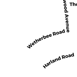
109 THORNTON RD
Owner Information
MCGANN, JOHN & SARAH
109 THORNTON RD.
WALTHAM, MA 02453


Property Details
109 THORNTON RD is classified as a Single Family Residential (Cape).
The primary structure on this property was built in 1933. There are 2,865ft2 of built area within this property. There is 2,865ft2 of residential/living space within this property. This property is listed as having 5 rooms.
109 THORNTON RD is valued at $713,400. The land is valued at $308,000 and the structures are valued at $405,400.
The most recent deed for 109 THORNTON RD is recorded at the local registrar in Book 67481, Page 201. 109 THORNTON RD was last sold on Thursday, June 23, 2016 for $670,000.
Assessment data from fiscal year 2022.
Flood Data
According to the FEMA National Flood Hazard Layer, this property does not appear to be in a flood zone. It may also be in an area not yet reviewed. Nonetheless, confirm this information prior to taking any action.
To view the flood hazards around this property, create a FEMA "Firmette" Map of the area around 109 THORNTON RD.
Broadband Internet Providers
| Provider | Type | Bandwidth (mbps) | |
|---|---|---|---|
| GCI Communication Corp. | Satellite | 0 | 0 |
| HughesNet | Satellite | 25 | 3 |
| VSAT Systems, LLC. | Satellite | 2 | 1 |
| Viasat Inc | Satellite | 100 | 3 |
| Verizon New England Inc. | Fiber | 940 | 880 |
| Comcast | Cable | 1000 | 35 |
| RCN | Cable | 500 | 20 |
Broadband service provider data from December 2020.
Adjacent Properties
- 105 THORNTON RD
Single Family Residential owned by LACROIX, BARBARA - 113 THORNTON RD
Single Family Residential owned by BONOMO, CHRISTIAN P - 134 VIRGINIA RD
Single Family Residential owned by DIMATTIA, AMY - 138 VIRGINIA RD
Single Family Residential owned by HSU, TAU H. - 142 VIRGINIA RD
Single Family Residential owned by MCMAHON, MARY ALICE &